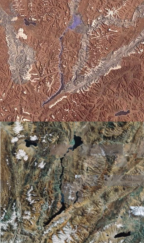
While this story is a few months old, I just came across it. Seems like China has accurate reproductions of the disputed Indo/China border down to scale - including accurate geographical features. Take a look below - the image on top is from China’s reproduction and while on the bottom is on Google earth.